How Drones Are Quietly Transforming Inspections, Surveys And Farming
A decade ago, drones were mostly associated with hobbyists and the occasional dramatic film shot. Today they have become everyday tools across a remarkable range of industries. Construction companies use them to track progress on building sites. Farmers monitor crops and livestock from above. Engineers inspect bridges, towers and roofs without scaffolding. Emergency services use them to search for missing people and assess bushfire damage.
The technology has matured rapidly, and its practical value is now well established.
Safer Inspections
One of the most significant benefits of drones is safety. Traditionally, inspecting roofs, towers, chimneys, bridges and other tall structures required people to work at height, often using scaffolding, cranes or rope access. These methods are expensive, time consuming and carry risk.
Drones equipped with high-resolution cameras can capture detailed images and video of structures from close range, allowing inspectors to identify cracks, corrosion, loose components and damage without leaving the ground. Thermal cameras can detect heat loss, moisture and electrical faults.
Construction and Progress Tracking
On construction sites, drones provide regular aerial snapshots that help project managers track progress, compare work against plans, monitor stockpiles and communicate with stakeholders. Time-lapse imagery documents the entire build. Mapping and surveying data can be used to calculate volumes, check levels and identify issues early.
Surveying and Mapping
Drones equipped with photogrammetry software or LiDAR sensors can create accurate maps, three-dimensional models and topographical surveys. These are used in planning, mining, civil engineering, environmental monitoring and land management. Drone surveys can often be completed faster and at lower cost than traditional methods, particularly over large or difficult terrain.
Agriculture
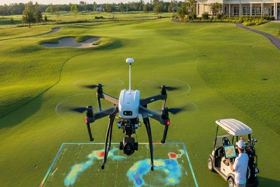
Australian farmers are increasingly using drones to monitor crops, assess plant health with multispectral imaging, check water infrastructure, inspect fences and locate livestock. Some drones can apply fertilisers and pesticides precisely, reducing waste and exposure. On large properties, drones save hours of driving and provide information that helps improve yields and manage resources.
Environmental Monitoring
Researchers and land managers use drones to monitor wildlife, map vegetation, assess erosion, track coastal changes and survey areas affected by floods or bushfires. Drones can access remote or sensitive areas with minimal disturbance.
Emergency Response
Emergency services use drones for search and rescue, assessing disaster zones and monitoring bushfires. Thermal imaging helps locate people in dense bush or at night. Real-time aerial views help incident commanders make informed decisions.
Regulations and Safety
Drone operations in Australia are regulated by the Civil Aviation Safety Authority. Commercial operators generally require appropriate certification, such as a remote pilot licence and, for many operations, a remotely piloted aircraft operator’s certificate. Rules cover where drones can fly, how high, how close to people and airports, and whether flights are permitted at night or beyond visual line of sight.
Privacy is another important consideration. Operators must respect privacy laws and be mindful of capturing images of people and private property.
Choosing a Provider
Engaging professional drone services gives businesses access to qualified pilots, advanced equipment and expertise in capturing and processing data, ensuring operations are conducted safely, legally and in a way that delivers useful information rather than just impressive footage. When choosing a provider, ask about certifications, insurance, experience in your industry, equipment and how data will be delivered.
Data Is the Real Value
The images and data captured by drones are only valuable if they are processed, analysed and presented in useful ways. This might include inspection reports, orthomosaic maps, three-dimensional models, volume calculations or annotated images. Consider how the data will be used and ensure the provider can deliver it in compatible formats.
Costs and Efficiency
While drone services involve costs, they often deliver significant savings compared to traditional methods. Reduced need for scaffolding, cranes, lane closures and manual labour can offset fees. Faster data collection reduces downtime and allows decisions to be made sooner.
Repeat flights add further value. Because drones can capture the same view from the same position months apart, asset owners can compare images over time and spot gradual changes such as spreading corrosion, vegetation encroaching on power lines, erosion along embankments or settling in structures. Planned maintenance becomes far more targeted when it is based on evidence of how an asset is actually changing, rather than fixed schedules or guesswork. For many organisations, this ongoing record becomes one of the most useful outcomes of a drone program.
Looking Ahead
Drone technology continues to evolve, with improvements in battery life, sensors, automation and artificial intelligence. Beyond visual line of sight operations, delivery drones and automated inspections are areas of rapid development. As regulations and technology advance, drones are likely to become even more integral to how industries operate.
A Bird’s Eye Advantage
Drones have moved from novelty to necessity in many sectors. By providing safer inspections, faster surveys and richer data, they help businesses work more efficiently and make better decisions. For organisations that have not yet explored what drones can offer, the view from above may reveal opportunities that were previously out of sight.